
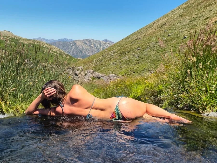
I test the water with my fingertips and pull my foot back — the river feels far too hot to step into. Still, I decide to try. Slowly, I sink into this natural bath, shaped by lava flows and volcanic ash on the slopes of the Chillán volcanoes. As my body relaxes, I look around at the unreal landscape: sharp transitions from volcanic desert to lush green valleys. Nearby, several rivers run toward the valley — each with a different temperature, from icy cold to almost boiling.
A moderate trekking route leads to the hot springs from the Nevados de Chillán ski resort. After two or three hours of walking, you find yourself almost alone in a fairytale-like valley, where you can spend the entire day moving from one natural pool to another, choosing the temperature that feels right. The experience is impossible to compare with “civilized” thermal spas, where spring water is funneled into identical concrete pools. And wild hot springs don’t require money — at least not directly. The mountain takes payment in muscle fatigue, but the experience is worth every step.
Chile is full of volcanoes and wild hot springs, but the Aguas Calientes valley in Chillán is one of the most accessible places where you can have a truly wild thermal experience a couple of hours away from a developed resort.
Route at a glance
Distance & elevation: 10–12 km, ~1,100 m elevation gain, max altitude ~2,400 m
Description: A loop hike from the Termas de Chillán / Las Trancas area to the Valle de Aguas Calientes. Plan 6–9 hours total, including soaking time. Parts of the trail are steep and sandy, with very little shade. Overnight camping is possible (wild camping).
Difficulty and preparation
The hike from Nevados de Chillán to the Aguas Calientes hot springs is best planned as a full-day trip, or at least a long half-day — depending on your fitness level and daylight hours. An overnight option works well too; the valley is ideal for camping. We spent about two and a half hours hiking to the springs, around two hours soaking, and another two hours for the return — at a brisk pace, with very few stops.
Most of the route is fully exposed, with almost no shade. A hat, plenty of water, and sunscreen are essential — sunny days can be brutally hot. You can refill water in cold streams along the way: one near the fumaroles early on, and another once you reach the hot springs valley.
Proper hiking shoes with good grip are important, and trekking poles are highly recommended. Some sections are steep and covered in compact volcanic sand. We managed without poles, but descents are noticeably safer and more comfortable with them.
Below I’m sharing a route map from a Wikiloc user. After that, I’ll walk through each section of the trail and share my own favorite soaking spots.
Powered byWikilocOpen route on Wikiloc
The route
The trail starts a little above the entrance to the Nevados de Chillán ski area, near the Parque de Aguas Termales complex. There is parking right at the trailhead.
The first section has the steepest climb but runs through forest shade. The trail is popular with mountain bikers, so stay alert — cyclists may pass at speed.
After 30–40 minutes, the trail reaches the fumaroles: clouds of steam rising from the ground, bubbling water with a sulfur smell, and every shade of yellow imaginable. Here, it becomes impossible to forget that you are walking on the slopes of an active volcano.
Nevados de Chillán is not a single volcano but a complex of several. Two peaks dominate the skyline, standing close together and resembling a miniature Mount Elbrus. They are simply called Volcán Chillán Viejo and Volcán Chillán Nuevo — the old and the new volcano. Chillán Nuevo is truly young: its modern shape formed just over a century ago, during an active phase between 1906 and 1945.
Such periods of activity occur regularly. While researching images of the volcano before 1906, I came across drawings from 1863 and 1875, both clearly showing a column of smoke rising from the crater. These illustrations are part of a Chilean landscape collection held by the National Historical Museum (pages 66–67). The book is fascinating well beyond Chillán. The drawings may not be masterpieces artistically, but their historical value is undeniable. It was striking to recognize places I had visited and see how they looked a century and a half ago.
The most recent volcanic cycle occurred between 2016 and 2022, forming several new craters. In recent years, the volcano has remained stable, with an official green alert level.
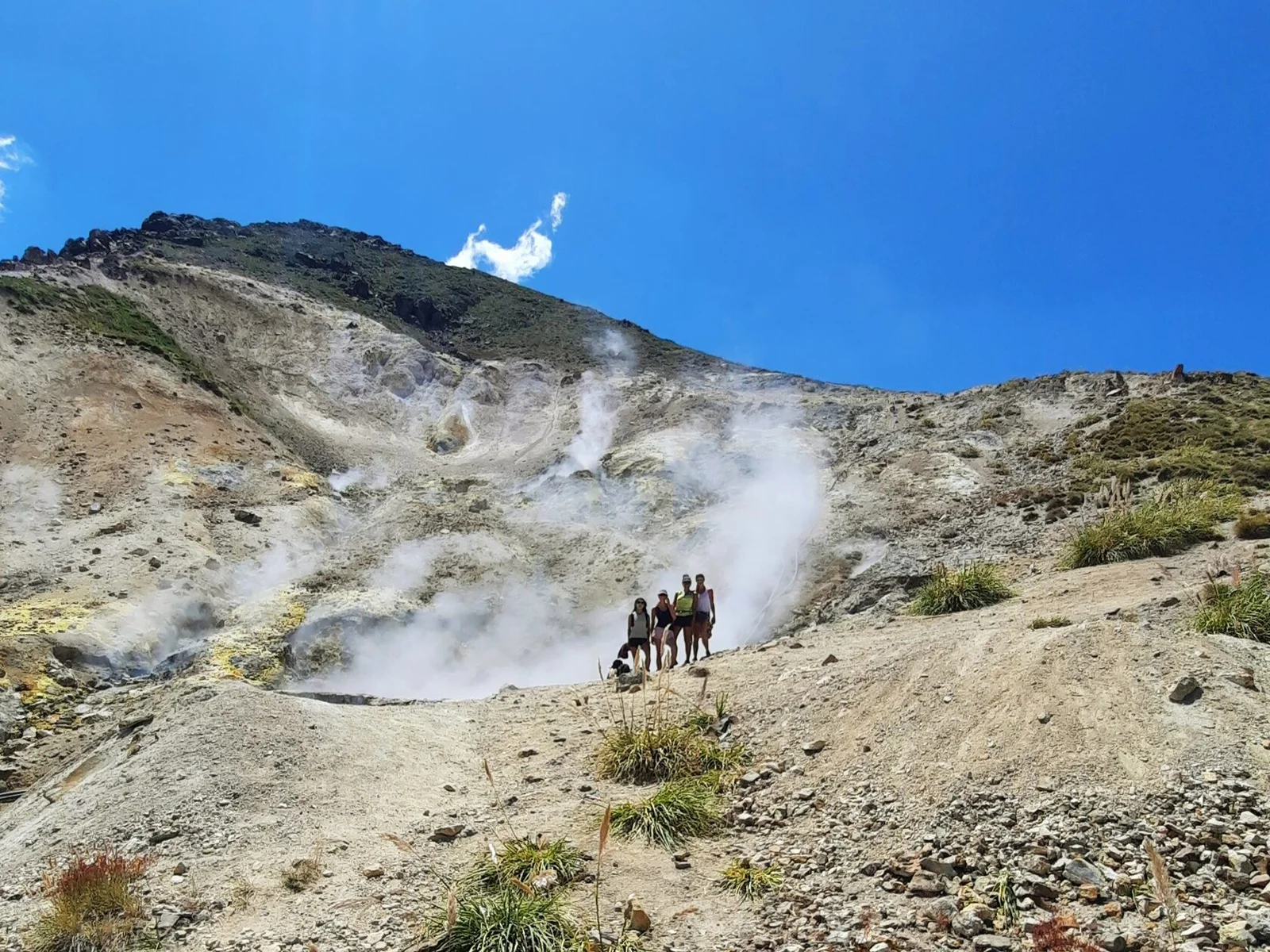
After the first fumaroles, the trail splits into two options (they rejoin higher up). One follows the ridge and then traverses right; the other drops toward a second set of fumaroles and climbs alongside a stream. I prefer the second option — it’s greener, cooler, and full of flowers thanks to the water.
Vegetation eventually fades, giving way to a volcanic desert. As you gain elevation, the views over the Las Trancas valley become increasingly dramatic.
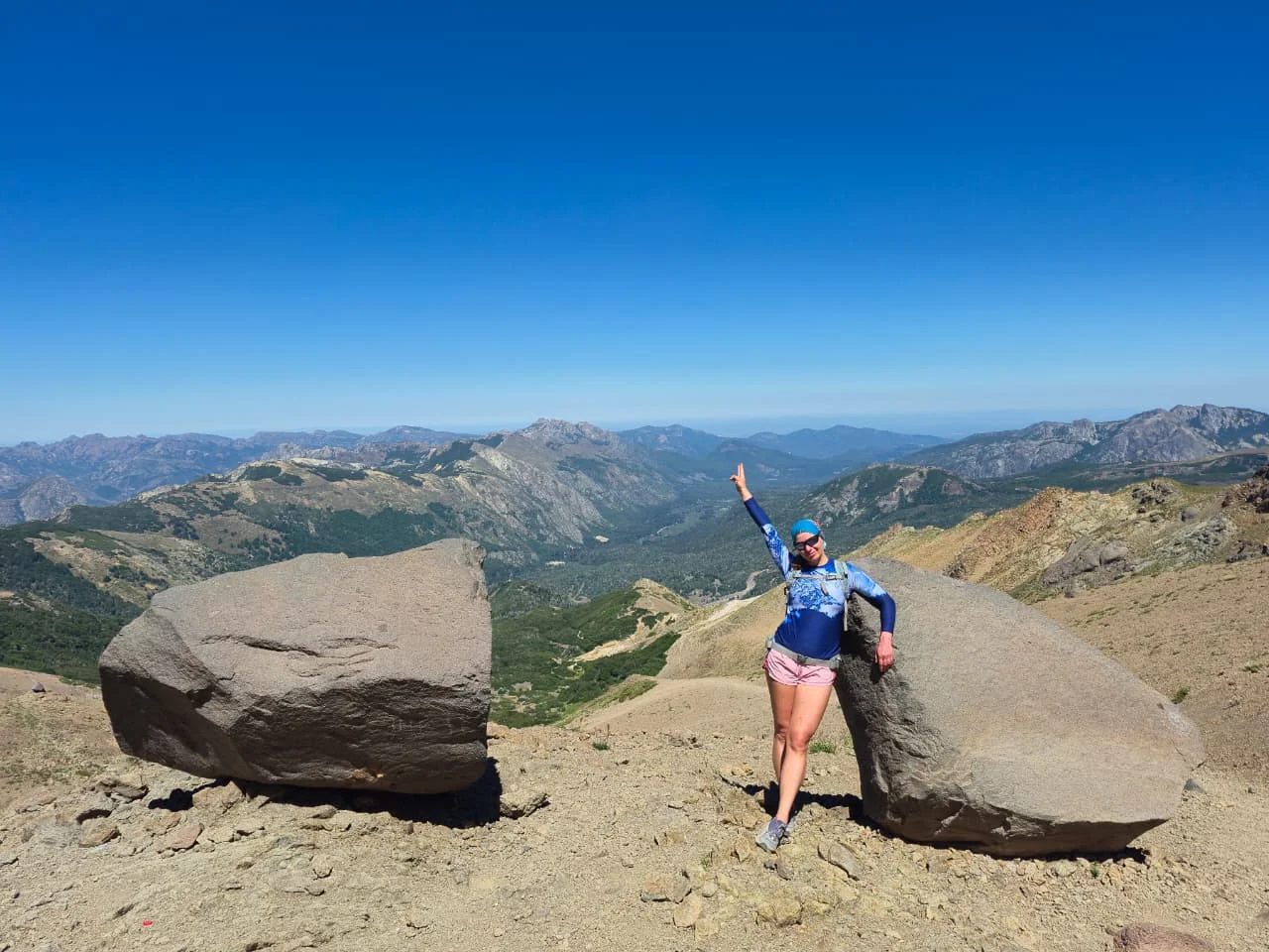
Once you crest the ridge, an epic panorama opens over neighboring valleys and the descent begins. The landscape feels completely wild — no towns, no ski lifts — and on the horizon appear the silhouettes of Antuco and Sierra Velluda volcanoes.
Soon, the Aguas Calientes valley comes into view, with several rivers winding through it. Two worlds collide here: a black, dry desert of rock and ash, and a lush green oasis along the riverbanks. The boundary between them is so sharp it feels drawn with a ruler.
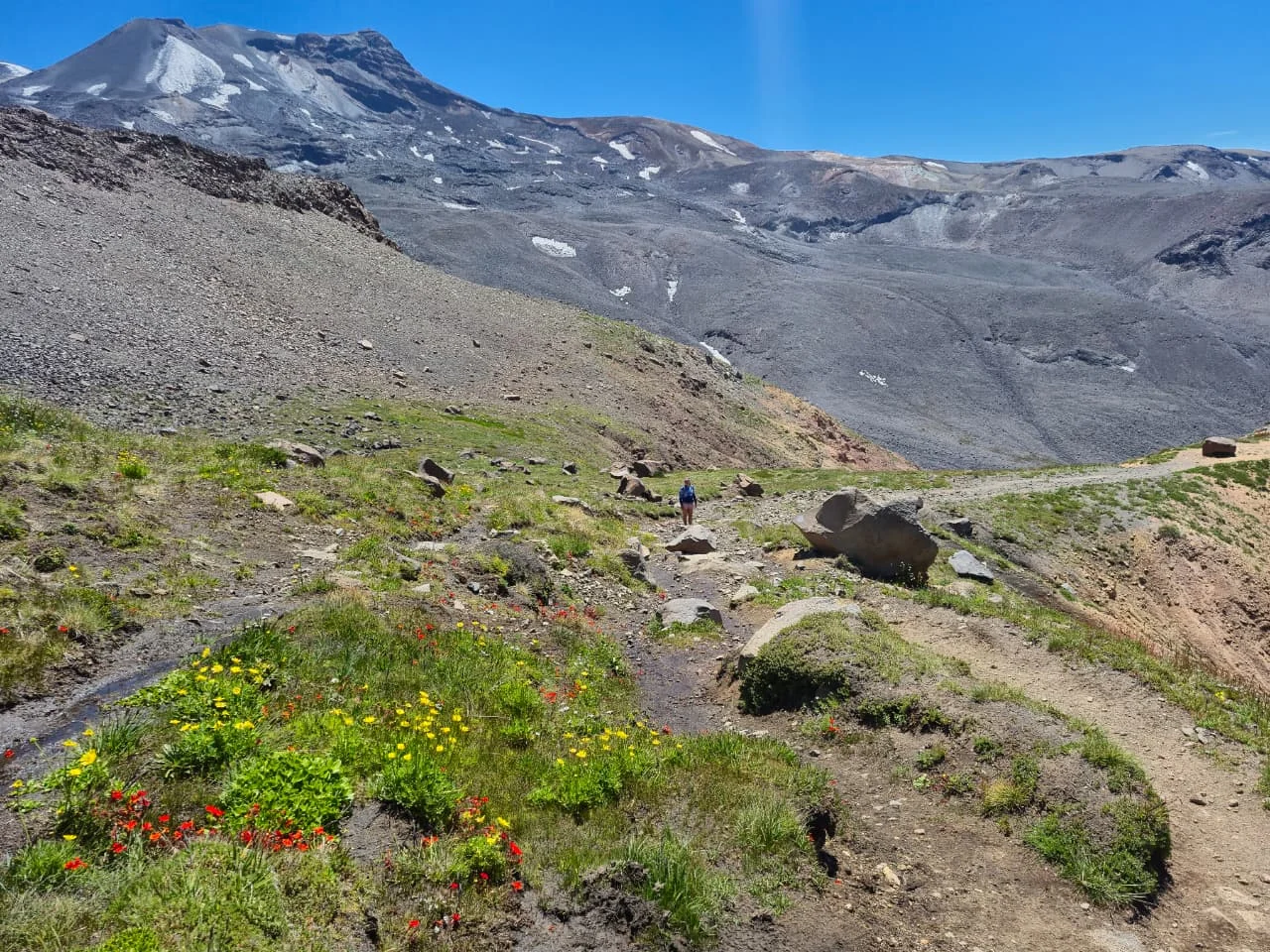
As you descend, you can already choose your soaking spots — pools, waterfalls, and connecting trails are clearly visible from above. The descent is steep and sandy, and trekking poles are especially helpful here.
The hot springs
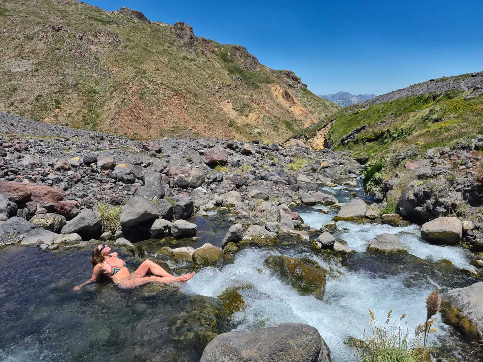
The valley offers bathing options for every preference: cold, warm, and hot water; calm pools and waterfall “hydromassage.” Once in the valley, you can walk around in a swimsuit, hopping between spots.
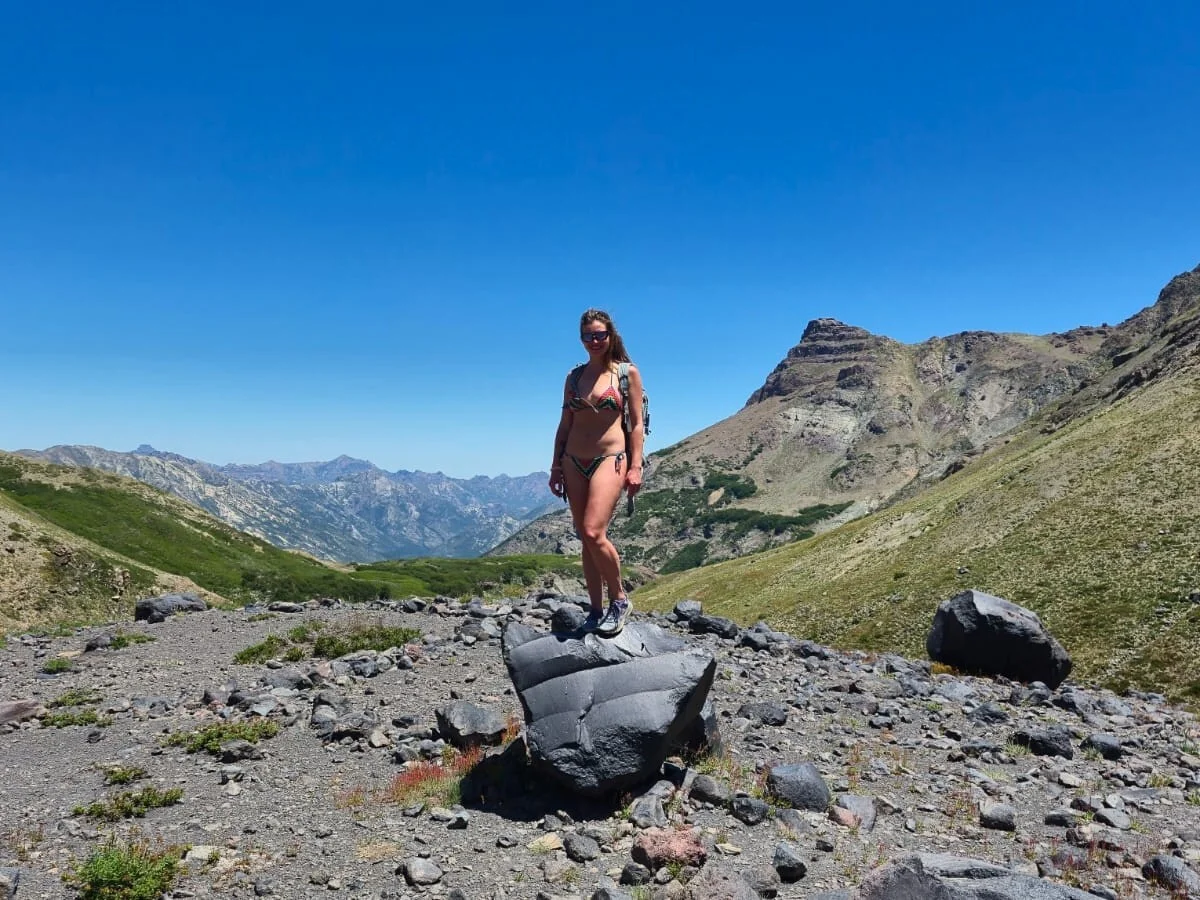
The first river after the descent is cold — perfect for cooling off after the hike, or refreshing yourself before the climb back out.
Beyond it lie green meadows where overnight hikers usually pitch their tents. In this lush setting flows a warm river with near-perfect temperature and views. Not hot, not cold — we stayed there for about half an hour without wanting to leave.
A further 5–10 minutes along the trail brings you to truly hot water. At first, we thought we wouldn’t be able to get in — or would instantly turn into soup. But the body gradually adapts to temperatures well above 40°C, and it becomes deeply relaxing. An unexpected bonus: after soaking, the air outside feels cool even on the hottest day.
What impressed me most is that these are entire hot rivers — not just a couple of warm puddles. Aguas Calientes is vast and secluded, despite being easily accessible by trail and so close to one of Chile’s largest ski resorts.
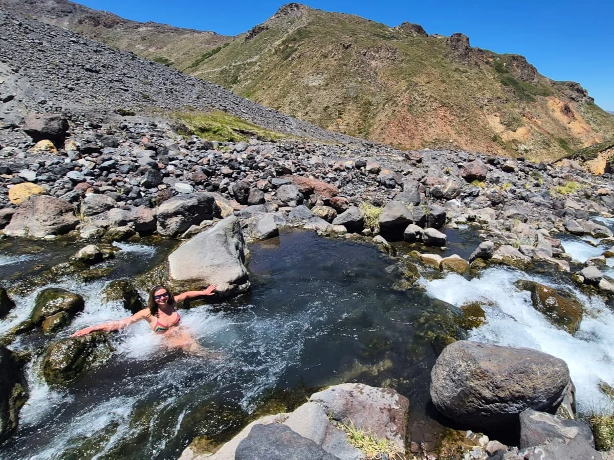
Lying in the hot water and looking at the landscape, I kept thinking how magical this place must be at night — soaking under a black sky full of stars. I’ve already decided to come back with a tent. Aguas Calientes absolutely deserves a place on the map of Chile as one of the best destinations for romantic trekking.
Follow the Crossing Borders Telegram channel to read more stories from Chile and beyond.